American Presidential Globes – George Washington
In honor of Presidents Day, Replogle Globes is beginning a series of posts about the history of U.S. presidential globes. The series starts with President George Washington. It will continue with Presidents Jefferson, Lincoln, Franklin D. Roosevelt, Eisenhower, Kennedy, Johnson, Nixon, and others. We have reached out to presidential libraries, museums, and historical associations to find out about each president’s globe.
From the very beginning, Presidents of the United States have felt the need to have a geographic globe by their side for easy reference. Upon being elected president in 1789, President George Washington arranged to have a globe sent to him. He ordered his agent “to send me by the first vessel, which sails for New York, a terrestrial globe of the largest dimension and of the most accurate and approved kind now in use.” The president received his globe in 1790.
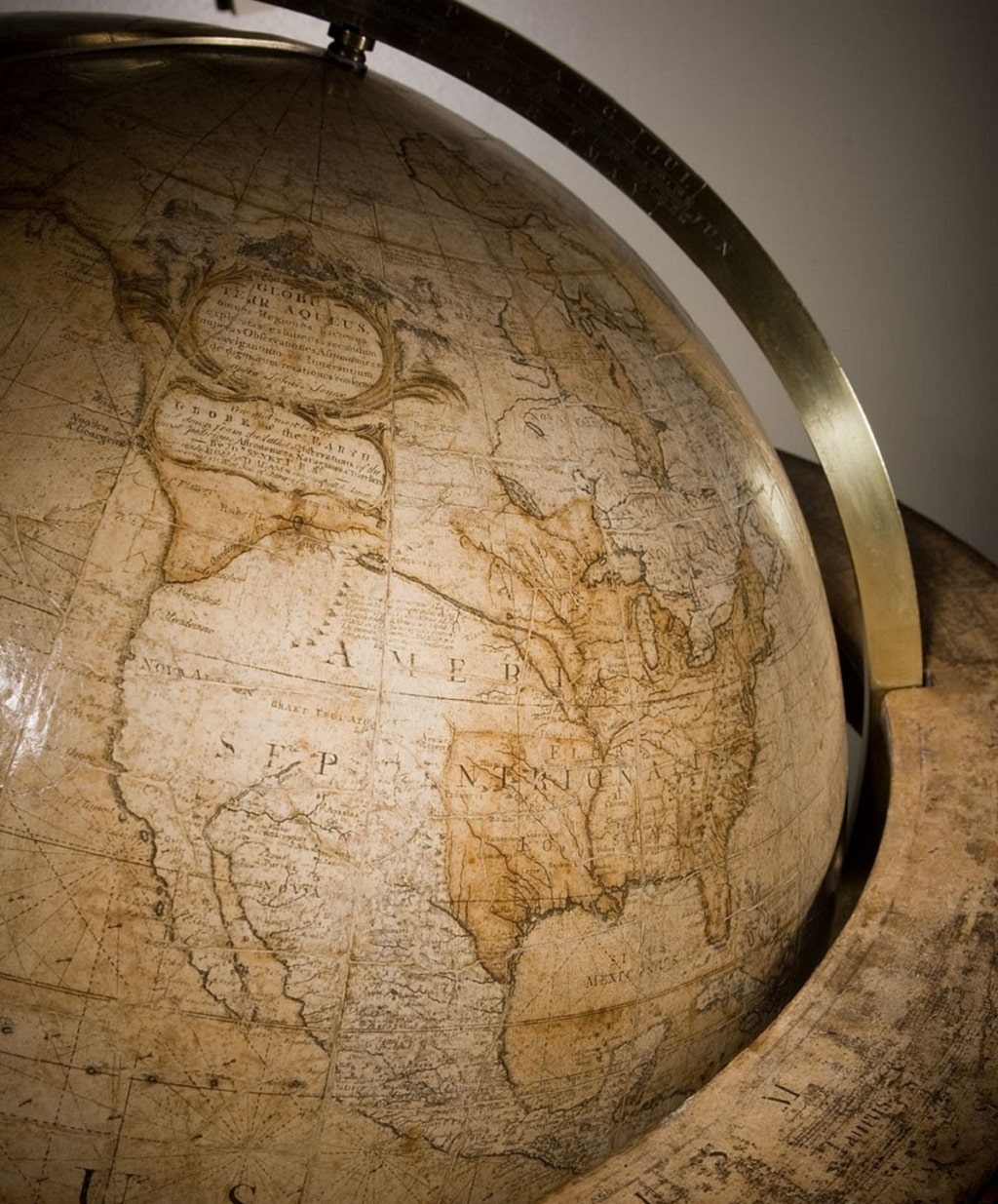
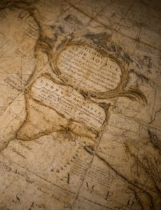
The new president’s 28” diameter globe was ordered from the same globemaker that supplied globes to British King George III. The same king was defeated by General George Washington in the American Revolution. London globemaker Dudley Adams invoiced Washington $27 pounds for the globe. According to one source, the $27 pounds paid was the modern equivalent of U.S. $5986. At the time Washington ordered the globe, there were no globemakers in the United States. The first American globe manufacturer, James Wilson, opened his factory nearly twenty-four years later in 1813. Washington would have likely ordered the globe from a U.S. company if he could have. He made a point of wearing an American-made suit at his inauguration at a time when European-made clothing was considered the best in “gentlemen’s fashion”.
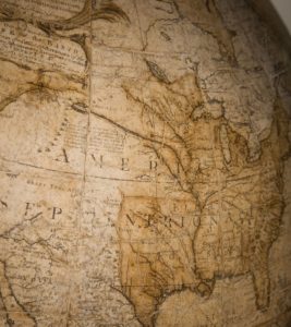
President Washington’s globe shows a much different world. At this point, the United States was comprised of the area of the original 13 colonies organized into 14 states (not all original state admissions had been ratified). South of the original area was Florida which included land in Southern Alabama and Southern Mississippi. At this time, not all maps and globes were entirely accurate. On Washington’s globe, Florida is shown extending much farther North, in what is now the center of the country, on land claimed by North Carolina and Virginia. Much of this territory was eventually ceded to the United States at the conclusion of the War of 1812. The area around New Orleans is depicted in detail, yet most of the inland territory west of the Mississippi River was not detailed. This area was largely uncharted and was eventually included in the Louisiana Purchase (1803) 14 years later. Washington’s globe was made before the territory was explored by Lewis and Clark, and that explains why this region has very little information on the globe. Captain James Cook’s voyage is shown on the globe (area not pictured).
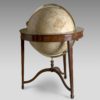
The Washington globe survives to this day and is in the permanent collection of Washington’s estate at Mount Vernon. The globe, which is made of layers of paper, plaster, and papier-maché over a wooden frame, underwent extensive restoration and the restored globe was presented to the public on October 27, 2005. Now it is possible to see the Washington globe at Mount Vernon. Photos courtesy of Mount Vernon Ladies Association.