What Are Raised Relief Globes and How Are They Made?
Raised relief globes are a unique and detailed way to view the world. They come in two main types: desktop-raised relief globes and floor-raised relief globes. These globes offer a 3D topographical representation of the earth’s surfaceWe’ll explore raised relief globes in great detail today.
What Are Raised Relief Globes?
 So what is a relief globe? Raised relief globes are a unique and detailed way to view the world. They are different from traditional globes as they feature a 3D topographical representation of the earth’s surface, providing an immersive and educational experience. The raised relief feature on these globes is created by physically molding the surface of the globe to match the topography of the earth.
This results in a globe with raised mountains and textured land masses, making it easy to identify different geographical features. An accurate raised relief globe is an essential tool for educators and students, as well as for those interested in geography.
Are Raised Relief Globes on a Scale?
Raised relief globes and raised relief maps are a unique way to view the world, but they don’t always represent the true scale of features. Due to the distance between the globe ball and the meridian, if raised relief was to scale, some features might exceed the space between the globe’s surface and the meridian.
A great example is Mount Kilimanjaro in Tanzania with a height of 19,341 feet and Mount Everest in the Himalayas with a height of 29,029 feet. To accurately represent Mount Everest at scale, it would require almost three times the height of the globe. Manufacturers stick to a standard height to identify major locations, rather than true scale.
How Are Raised Relief Globes Made?
The process of creating these textured world globes involves various techniques, such as layer stacking, vacuum forming, solid terrain modeling, and 3D printing, each with its own unique benefits and drawbacks. Let’s explain each step.
Layer Stacking
Layer stacking is a technique in which map-makers cut sheet material in successive layers, following the edges of a topographical map’s contour lines, then stacking these resulting layers to approximate the look of the terrain. This method can be time-consuming and costly, but it is a good option for creating a durable plaster alternative.
Raised Relief Vacuum Forming
 Vacuum forming is a process where a master terrain model is made using a milling machine, followed by creating a reproduction mold. The mold is then cast, holes are drilled into it, and a plastic sheet is fitted over it. An airtight seal and heater are applied, resulting in a plastic raised relief map.
3D Printing the Raised Mountains
3D printing is the newest and fastest-growing method of making raised relief maps. It involves rendering 3D DEMs within a computer program and then sending them to a 3D printer. Plastic layers are built on top of one another and color is applied, resulting in a tangible 3D raised relief map.
Solid Terrain Molding the Globe Relief
Solid terrain molding is a technique that involves cutting dense polyurethane foam into the desired location shape and then directly printing digital elevation data on top of it. This method is not high-speed or cost-effective for mass production, but it is useful for creating large-scale “one-off” models.
What Materials Are Used to Create a Raised Relief Globe?
 Creating relief globes requires several materials, including high-grade rigid vinyl for the pre-molded map sheet. This plastic material is ideal for the process as it stretches just enough under heat and can be printed by most print shops.
Additionally, a digital file must be created that corresponds to the mold dimensions, taking into account the fact that the print will be melted and stretched. The final product can either be a technical and large raised relief map or one that is more focused on aesthetics than accuracy. The same mold can also be used for multiple styles of maps as long as it is still in good condition.
Conclusion
In conclusion, relief world globes are not just a boring representation of topographical information, they’re a visual masterpiece. Imagine having the ability to physically see the elevations of different regions, it’s truly an experience like no other.
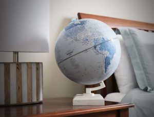
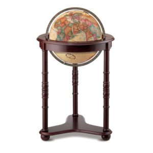
Whether you’re looking for a desktop-raised relief globe or a floor-standing one, Replogle Globes has got you covered with a variety of options to choose from and an easy-to-use website. Don’t just take our word for it, head on over to Replogle Globes and see for yourself!
Don’t hesitate to contact us for more information!